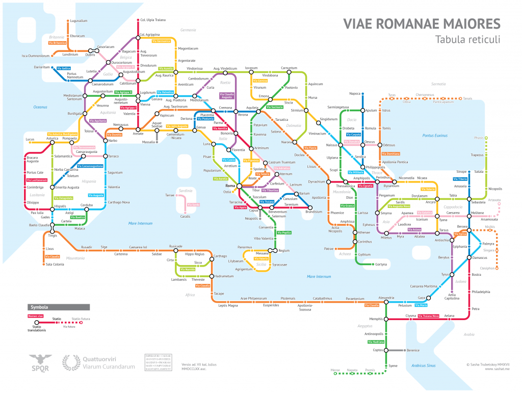
From Open Culture:
- Ancient Rome’s System of Roads Visualized in the Style of Modern Subway Maps
- The Roman Roads of Spain and Portugal Visualized as a Subway Map
- The Roman Roads of Britain Visualized as a Subway Map
It’s hard for me to pinpoint exactly why these appeal to me so much but in part it’s because:
- The graphic designer in me has always loved this style of transit maps and the application of something familiar to something so ancient seems cool.
- Order. There must be order, in all things.
- I’ve always loved maps. Perhaps for the reason outlined in #2.
- There is a large part of me that would love to pack a bike with food and camping gear and disappear on these for an undetermined amount of time.
I realize that according to some of the notes on the maps, many of these roads no longer exist or have been converted to modern roads – but in my mind – they’ll always be cobbled trails and dirt cart paths. Don’t ruin it for me.
